Edit With Your Article Title
PASI
SEISMIC REFRACTION
This geophysical method is based on measuring the arrival times
of seismic waves refracted by the interfaces between layers of ground,
characterised by different propagation speeds. The energy source
is represented by an impact on the surface. The energy radiates
from the "shot point" - travelling both directly in the
uppermost layer (direct arrivals), and deep down and laterally along
layers at a higher speed (refracted arrivals) - then returning to
the surface, where it is measured through the spreading of geophones
geophone spreading (10 Hz frequency). Energising in different positions
on the surface, it will be possible to deduce information about
the geometry of the deep refractor layer, in many cases coincident
with the bedrock.
SEISMIC REFLECTION
This geophysical survey is based on measuring the outbound/inbound
travel times of the seismic waves transmitted from the surface and
reflected towards the surface of geological horizons with different
characteristics. The energy transmitted is only reflected when there
is a contrast of acoustic impedance (the product of the speed x
the density of the material) between two superimposed layers. The
scale of the contrast in the acoustic impedance between the two
layers determines the amplitude of the reflected signal, which is
measured on the surface thanks to a spreading of high frequency
geophones (40 Hz, 100 Hz). As in the case of seismic refraction,
the energy is produced by a ¨shot¨ or impact on the surface.
For surface applications, this involves the use of a sledge hammer
and a striking plate, a dropping weight, a seismic energiser or
an explosive charge.
DOWN HOLE & CROSS HOLE
In this type of seismic survey, the source and/or geophones are
located in a hole prepared especially in the ground. One of the
most common methods involves down hole testing (the source is on
the surface, the sensor on the other hand is a 3D borehole geophone
(P- & S-waves) or a chain of hydrophones (P-waves only, in a
hole filled with water or drilling fluid). The down hole test aims
to determine the profiles of the seismic compression waves (P-waves)
and shear waves (S-waves) with the depth. It consists of producing
a perturbation on the ground surface by means of a mechanical source
and measuring the arrival time of the P- and S-waves at various
depths in the hole prepared for the purpose. This technique is also
used for calculating the Vs30 as an alternative to surface methods
(e.g. MASW). Cross hole seismic tests, on the other hand, involve
measuring the speed of the seismic waves between two survey holes,
one for energisation (normally made with a borehole energiser or
explosive) and the other for measurements (with a three-dimensional
borehole geophone clamped at a certain depth). For each acquisition,
the energisation depth and measuring sensor depth in the two holes
should be the same. In this case, therefore, there must be two separate
survey holes whose reciprocal distance from all the measurement
levels must be known.
MULTICHANNEL ANALYSIS OF SURFACE WAVES (MASW)
MASW is the acronym for Multichannel Analysis of Surface Waves.
This indicates that the phenomenon being analysed is the propagation
of surface waves. More specifically, the analysis focuses on the
dispersion of surface waves (i.e. the fact that different frequencies
– with different wavelengths - travel at different speeds).
The basic principle is quite simple: the various components (frequencies)
of the seismic signal that is being propagated travel at a speed
that depends on the characteristics of the medium. More specifically:
the larger wavelengths (i.e. the lower frequencies) are influenced
by the deepest layers, while the small wavelengths (the highest
frequencies) depend on the characteristics of the layers nearest
the surface. As, typically, the speed of the seismic waves increases
with depth, this will be reflected in the fact that the lowest frequencies
of the surface waves will travel at a higher speed than the higher
frequencies. MASW is traditionally performed by analysing Rayleigh
waves, which are recorded using common 4.5Hz vertical component
geophones - those used also for refraction in compressional waves
- and considering a very common source with vertical impact, i.e.
the classic sledge hammer. This occurs for at least two reasons:
1. these geophones (and this acquisition method) are by far the
simplest and most common. 2. the propagation and dispersion of Rayleigh
waves occurs without any problems even in low speed channels (speed
reversals) which, as we know, are invisible for refraction. On the
other hand, exploiting the dispersion of Love waves (together with
that of Rayleigh waves) is an exciting new frontier for MASW analysis
(see the winMASW manual for more information) (please note that
the use of Love waves is only possible with the MASW technique and
not with the ReMi – Refraction Microtremors - technique).
In summary: as the dispersion of the surface waves depends on the
characteristics of the sub-soil (mainly on its vertical variations),
by determining the dispersion curves, it is possible to deduce the
characteristics of the medium (the essential parameters are the
speed of the shear waves and the thickness of the layers) and all
the parameter requested by the new seismic regulations introduced
in most Countries all over the world. slut PASI
HVSR
In light of the new seismic legislation, the measurement of environmental
seismic vibrations or seismic noise has acquired considerable importance.
The analysis of seismic noise measurements can be conducted using
three methods: Fourier spectra Spectral ratios H/V spectral ratios
The latter, which provides the most reliable results, is also known
as the HVSR (Horizontal to Vertical Spectral Ratio) method or the
Nakamura method. The H/V spectral ratio technique consists of calculating
the ratio of the Fourier spectra of the noise in the horizontal
plane H (generally the spectrum H is calculated as the average of
the Fourier spectra of the horizontal components NS and EW) and
the vertical component V. The acquisition of HVSR data, obtained
using low frequency triaxial (3D) geophones, make it possible to
determine with accuracy the characteristic frequency of resonance
of the site, an essential parameter for the correct dimensioning
of earthquake-resistant buildings. During the design, it is important
to build structures with different resonant frequencies to the ground,
thereby preventing the ¨double resonance¨ effect which is
extremely dangerous for structural stability. Seismic microzonation
studies using the HVSR measurement method have therefore become
an integral, essential instrument in the design of earthquake-resistant
buildings.
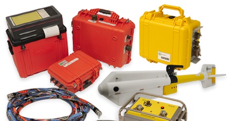
geomatrix Seismic Exploration Systems These instruments are suitibale
for near survface Refraction, Reflection, MASW and MAM investigations
for all engineering disciplines. Seismic download Systems Downhole
and crosshole techniques aid derive higher resolution P & S Wave
velocity measurements for improved engineering ground models. Seismic
Monitoring Used to measure strong and weak motion events, aftershocks
and very deep lithology. These systems are also used for monitoring
large structures. ABEM Near-surface seismics is a method that utilizes
a vibration source to measure propagation of elastic waves. The
results will show the mechanical properties of the ground. Common
applications are soil stability, rock quality and depth to bedrock.
ABEM Terraloc Pro is a seismograph that can be used for seismic
surveys ranging from simple refraction measurements to complex 3D
cross-borehole tomography. SHALLOW SEISMIC REFRACTION In this type
of survey you examine low and high velocity layers down to the basement
rock, and map tectonic features and quality changes. Features within
the overlaying sedimentary layers are also investigated. SHALLOW
SEISMIC REFLECTION Reflection surveys are becoming more and more
popular for shallow studies thanks to significant improvements in
the dynamic range of modern seismographs. Reflection surveys require
powerful filtering, on-board trace scaling, high frequency energy
sources and high frequency geophones for the best results. MASW
(MULTI-CHANNEL ACQUISITION OF SURFACE WAVES) Determine engineering
modulii through the measurement of surface or Rayleigh waves, all
that is needed is an impulsive energy source such as a hammer or
PEG-40, and a standard Geode with 4.5 Hz geophones. 1D or 2D measurements
can be taken very quickly in the field. For deeper investigations,
record passively utilising background noise from traffic or construction
as your energy sources. As these vibrations tend to be of a lower
frequency, the resulting shearwave profile yields greater depths.
Combine these measurements with active source measurements for a
complete shear wave profile to the ground surface. Geometrics'
seismograph
Geometrics is a division of OYO Corporation and headquartered in
San Jose, CA. The company is a worldleading designer and manufacturer
of land, marine and airborne geophysical hardware, sensors and software,
covering seismic, magnetic, and electromagnetic technologies. Founded
in 1969, Geometrics began operations developing innovative magnetometers,
and now has representatives worldwide in over 50 countries. With
over 46 years of field experience and extensive knowledge, Geometrics'
staff of engineers and technicians has worked with universities,
research institutions, government agencies and exploration companies
to provide solutions to all kinds of geophysical and geotechnical
exploration needs.
ABEM
seismograph
Aktiebolaget Elektrisk Malmletning (ABEM), a producer of electrical
equipment for ore prospecting, in 1923. Shortly afterwards, Sveriges
Geologiska Undersökningar (SGU), the company that developed
the first electromagnetic loop for ore and metal detection, established
an office in Malå, in northern Sweden. The success story grew
from there. By the 1950s, ABEM was Europe's largest geophysical
consulting company, while SGU eventually evolved into MALÅ
GeoScience AB with a proud heritage of technical developments and
world-beating innovations, leading to today's pre-eminence in ground
penetrating radar (GPR).
ABEM and MALÅ joined forces in the early 1990s and were incorporated into Guideline Technology AB between 2007-2011.
abc